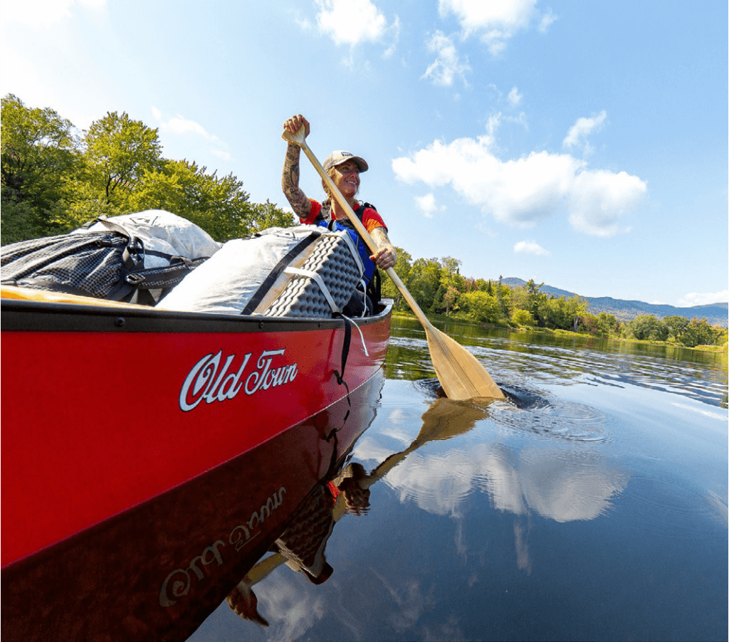
Kayaking & Canoeing
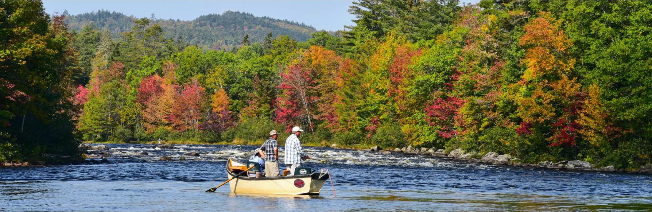
Experienced canoeists and kayakers: For white-water adventurers, the East Branch of the Penobscot River has Class 2-3 rapids and a couple of falls where por-tages are a must. The West Branch of the Penobscot River has rapids for Classes 1-5.
For kayakers the region is a paradise! The West Branch of the Penobscot River attracts paddlers from all over the world with the foaming challenge of The Crib-works, a class 5 rapid, that brings an adrenaline rush to the most experienced pad-dlers. Remote excursions to the Allagash Wilderness Waterway or St. John River commence from this region. Trip outfitting, canoe and kayak rentals and guide services are available.
For the less experienced or new paddlers the choices are endless. Flat water, scenic day or ½ day trips provide hours of enjoyment. Always check the weather before venturing out on any of the lakes and rivers. Maine’s boating law requires all watercraft to carry at least one Coast Guard approved Personal Flotation Device per person.
A. JERRY POND
Located in Millinocket, Jerry Pond is a perfect place to paddle. The pond is located off Massachusetts Avenue and has parking, public restrooms, picnic tables, grills, a dock and a children’s playground. The pond is stocked with brook trout and is open to fishing for youth ages 15 and under.
B. MEDWAY RECREATION AREA
Located on Rt. 157, the Medway Recreation Area on the East Branch of the Penobscot River offers beautiful scenic paddling. There is parking, a sand beach, picnic tables and more. From the beach paddlers can choose to paddle 2 miles upstream or 5 miles downstream.
C. MILLINOCKET STREAM
Park and put in at Crandall Park located on Congress St. in Millinocket. Paddle left upstream past the Stearns Jr./Sr. High School Complex and continue for approximately 1 mile to the railroad bridge. At this point you can either turn back or portage on the right side to the snowmobile bridge. Put in and continue for another 1/4 mile. At that point turn around and enjoy the straight paddle back to Crandall Park. This is an easy paddle and takes approximately an hour. Scenery and wildlife along the way. At Crandall Park paddle downstream and at the large elbow enter Shad Pond. Paddle right on all flat water to Grand Falls. If you prefer class 2 rapids, paddle left to Pond Falls and Dolby staying to the left hand shore. You will need to park a vehicle at Dolby for this option.
E. PUBLIC BOAT LANDING ON MILLINOCKET LAKE
Across the way from Ambajejus Lake is lovely Millinocket Lake, which offers spectacular views of Mt. Katahdin, loons, eagles and more. There is parking at the public landing. Bring your camera, picnic and swimsuit. This lake is very rocky so beware.
F. PUBLIC BOAT LANDING ON SOUTH TWIN LAKE
Take Rt. 11 South for approximately 7 miles and turn right at Marina Dr. (5 Lakes Lodge) to the public boat landing. From there enjoy unlimited lake paddling offering extraordinary views of Mt. Katahdin.
G. GRANT BROOK FROM MILLINOCKET LAKE
From the boat landing, paddle left in a northeast direction. Keep to the left of a small island with 1-2 camps on it. If the water level is high, paddle to the left of a large wooded island (0.8 miles from the boat landing). If the water level is down, paddle to the right of this island. The outlet of Grant Brook
(200 yards wide) is just beyond this island. You would be about 1.1 miles from the boat landing. As you paddle up the inlet (north), it gets narrower. It is a swampy open area with trees 50-100 yards back from the water. A mile from the lake, Grant Brook is only 15-50 feet wide with trees coming down to the water. This is one of the best places to observe moose.
H. POCKWOCKAMUS DEADWATER INTO RIVER POND
Located 18 miles north of Millinocket on the Golden Rd.
At the North Woods Trading Post go 7.6 miles up the Golden Rd. and take a left unto a wide gravel road. Go 0.6 miles and the put-in is on the left where there are 4 large rocks blocking the entrance. There is a 400 foot trail to the river. Paddle upstream 0.5 miles to Pockwockamus Falls, or downstream 2.5 miles through the deadwater to Debsconeag Falls. A special point of interest is River Pond; in June, if you paddle downstream 0.8 miles then go left and up into River Pond there is a good chance to see moose in the pond. Great views of Mt. Katahdin as well.
I. UPPER AND LOWER TOGUE PONDS
The scenery doesn’t get much better than from Togue Ponds. Located on the Baxter State Park Rd., about 17 miles from Millinocket, there is a beach, picnic area, visitor’s center and boat access. Upper Togue is a little more remote and has a more varied shoreline but Lower Togue is beautiful as well. You will get spectacular views of Mt. Katahdin as you paddle. Look for loons, hawks and warblers. You may even see a painted turtle. Beavers make their lodges in Upper Togue and you will spot stumps and trees strewn over the hillside. Look for mink on Lower Togue.
J. PASSAMAGAMET LAKE VIA THE WEST BRANCH
Located 14 miles north of Millinocket, take the Millinocket Lake Road 9 miles and bear left onto the Golden Road (across from North Woods Trading Post), then drive 2 miles and turn left onto the Grant Brook Road (a good gravel road). Drive 2.8 miles to the bridge, put in on the right just before the bridge and paddle about 1.3 miles upriver. The entrance to Passamagamet Lake is on the left. There is a beach on the left shore 0.8 miles from the river and beautiful views of Mt. Katahdin. This paddle is recommended in mid to late summer when there is less current in the West Branch.
Nature Conservancy, Debsconeag Lakes Wilderness Area There are three carry-in boat launches in the Debsconeag Lakes Wilderness Area.
K. HURD POND BOAT LAUNCH
Bear left on the Hurd Pond Rd. right after Abol Bridge. At the fork go to the right and drive about one mile to the end of the road and the put-in for Hurd Pond.
L. LITTLE HOLBROOK POND
Cross Abol Bridge, drive 9.9 miles on the Golden Road and turn left. Drive about ½ mile to the end of the road and the put-in is a short carry to Little Holbrook Pond.
M. OMAHA BEACH
Located on land managed by Katahdin Forest Management; approximately 4.2 miles past Ambajejus Lake on the Golden Rd. turn left. Bear right about 2.5 miles down the road to the public boat landing. From the landing and Debsconeag Deadwater it is a quick paddle into first Debsconeag Lake. This road may not be passable for vehicles with low clearance.
Katahdin Woods and Waters Scenic Byway Rt. 11 Grindstone Road (Hay Brook Area)
Directions to put-in from Rt. 157: Take Rt. 11 North at the intersection in Medway (blinking yellow light). Drive north approximately 12.3 miles to Grindstone. After crossing a small cement bridge (Hay Brook), drive another 200 feet and turn left on a narrow dirt road and drive another 300 feet to the put-in. You will be at the East Branch of the Penobscot River.
N1. HAY BROOK
This is an easy 1-1 1/2 hour paddle—approximately 2 miles round trip. Paddle down the East Branch nearly 1/4 mile, then take the first left, paddle under the bridge and up Hay Brook. No current on this narrow—very crooked—brook surrounded by many song birds.
N2. LOWER MUD BROOK
This is an easy 2.6 mile paddle round trip and will take approximately 1-2 hours. At the put-in, paddle upriver about 300 feet and take the first right. This is
a narrow winding brook with no wind. Nearly a mile up Mud Brook there is a beaver dam and quiet water paddling for another half mile above the dam, then it becomes quick water. You may either portage around the quick water on the right side, or return to the put-in, drive up Rt. 11 North 1 mile and take the first left (small turn-out) and carry 150 feet to Mud Brook.
O. PENOBSCOT RIVER TRAILS
Penobscot River Trails is a nature preserve which is privately owned by a family funded Maine registerd charitable foundation. They have snowshoeing and Cross-Country skiing in the winter, and hiking, biking and boating will be allowed in the summer months. At this time however, you must bring your own equipment. There is no fee to use the facility when it’s open.The plan is to officially open sometime in July. No dogs or pets of any kind allowed. For more information, check out facebook.com/PenobscotRiverTrails/
P. 5 MILE PADDLE ON THE EAST BRANCH
Big Seboeis to the East Branch of the Penobscot River
Follow signs to Lunksoos Base Camp from the Swift Brook Road. Lunksoos Boat Launch is your take out and is on the East Branch of the Penobscot River. Potable water is available at the hand pump outside of Lunksoos Base Camp. Please sign-in at the kiosk here.
Drop one shuttle vehicle there and continue another mile to the Sherman Lumber Road. Turn left and follow Sherman Lumber Road, yielding to any logging traffic, approximately 4 miles.
Put-in is at Truck Bridge over the Seboeis River just beyond Mile 14 on the Sherman Lumber Road. Cross over the river and turn left. This is an old forestry campsite and easy access away from logging road traffic.
The river winds its way through shallows and “Bogans”. Approximately 3 miles downriver the Big Seboeis enters the East Branch of the Penobscot River. Shortly after this you will see the Big Seboeis Campsite on the right. From this campsite you can find the connector trail leading to the Ed Werler Trail up Deasey Mountain.